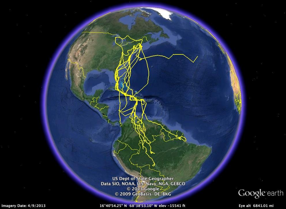
Tango 2013-14
 |
Tango's Fall 2013 MigrationTango moved steadily down the Osprey Highway to the Tropics. Thi is the first time we've followed him, so we didn't know where he was going--but he did. He settled down at Lake Valencia in northern Venezuela. This turned out to be his wintering area. Sadly, after a full winter on the lake, something happened to Tango after we got his last text on (Scroll down for detailed maps.) |
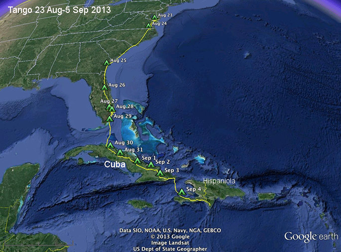 |
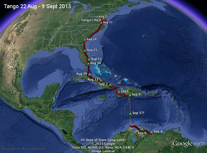
Ready for the CrossingTango was the second of our GSM-tagged birds to head south. He left home on 24 Aug, which is early for an adult male. He made a big move on the 25th and then moved through Florida, arriving at Key Largo on the 29th, where he spent the night. He took off for Cuba at 9AM on the 30th. He made steady progress along the Island and crossed over to Hispaniola on the 4th. Our last signal from him was down on Cabo Beata, where so many Ospreys are funneled before making the 4-500 mile crossing down to South America. |
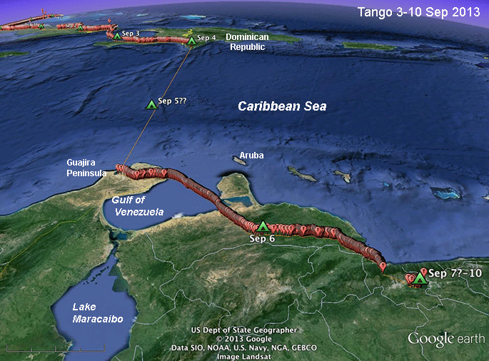 |
Safely acrossTango made short work (14 hours and 12 minutes) of the 370 mile (600 km) crossing from Hispaniola down to South America. At this point, we hadn't yet received all his data, so we didn't know how he got across the Caribbean. Those details, received some days later, are mapped below. |
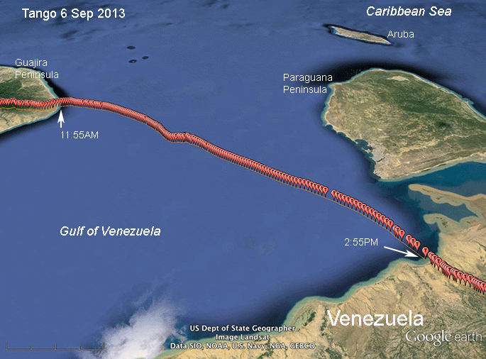 |
Across the Gulf of VenezuelaTango crossed the Gulf of Venezuela in exactly 3 hours. The trip was 81 miles (129 km). His speed was 27 mph, which is typical of our tagged birds moving over open water. The zig-zag seems to have been about finding a thermal somehow out over the open water. I used to think thermals (hot rising air that birds use like elevators to gain altitude) only occured over land. I was wrong. In certain circumstances, they are found over open water as well. |
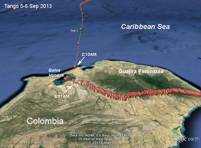 |
On familiar groundTango arrived in south America right around 2:10AM. He continued on to Hondita Bay, where Jaws, our first satellite-tagged juvenile to make it to South America, spent his 16 months in the tropics. Tango only rested for about 5 hours. He probably caught a fish before continuing his migration. Most birds that arrive on the Guajira Peninsula (which is most of our birds) head more or less due south, staying west of the Gulf of Venezuela and Lake Maracaibo. |
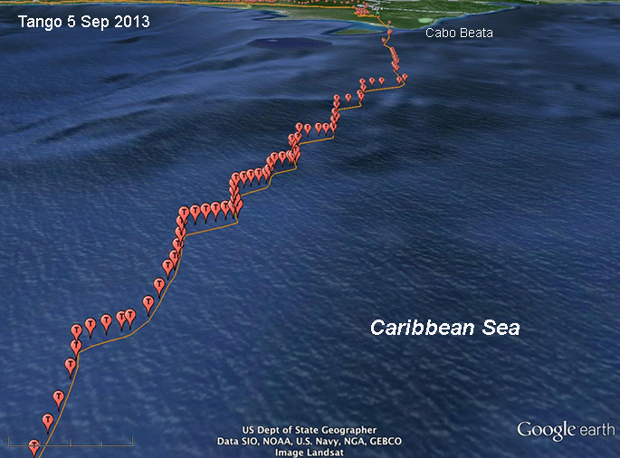 |
Across the Gulf of VenezuelaThis map is out of sequence, but it's the way we got the data. Tango's first download from Venezuela didn't have the locations for his Caribbean crossing. A few days later we got his data for his trip from the Dominican Republic on Hispaniola to the Guajira Peninsula in northeastern Colombia. The trip was 370 miles (600 km) and could not have been any shorter. It took Tango just a bit more than 14 hours, at an average speed of 27 mph (42 kph). The really cool thing about this track is that it documents him tacking back and forth as he heads south over the open water. When we look at the altitude data, we see that on each of the westward zigs he gained an average of 576 ft (189 m) in an average of 5 minutes. He then turned southeast and coasted down before tacking back to the southwest, climbing again. We need to get the wind data to understand the dynamics of what he was doing, but it's something that's never been documented in an Osprey crossing open water before! |